Guide to the Colorado River in the Grand Canyon 5th Edition
Sold out
$19.95
SKU 18569
Do you want a Grand Canyon guidebook written by boaters for boaters?
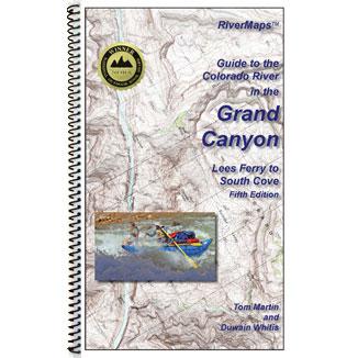
Tom Martin, author of Day Hikes from the River, and Duwain Whitis, publisher of RiverMaps map books, have teamed up to write a guidebook. This is the only guidebook to the Canyon with USGS topographic map backgrounds printed at their original scale, with additional details in an easy-to-read format. It is also the only guide with maps extending to South Cove in Lake Mead. Each map shows campsite locations, rapids, scout points, river miles and other points of interest. The accompanying text describes all campsites on the park inventory (and some extras), with campsite pull-in information, geological, botanical and historical points of interest. Maps and photos are in color. The guide is 8.5" x 14" spiral-bound to lay flat. The new mileage featured in this edition has been established by the Grand Canyon Research and Monitoring Center, using the most up-to-date measuring techniques. The new mileage deviates from the old by up to a mile in certain areas.
The guide is 8.5" x 14" spiral-bound to lay flat. The new mileage featured in this edition has been established by the Grand Canyon Research and Monitoring Center, using the most up-to-date measuring techniques. The new mileage deviates from the old by up to a mile in certain areas.
The 118 pages are printed on tough waterproof and tear-resistant synthetic paper. 978-09819395-7-5. 51 maps, 297 miles, all-color photos and shaded topographic relief.